 This trip was a quick hop from Area Irish Sea – once known as Area Mersey – to Area Thames, which runs from the border with Humber down to North Foreland in Kent. I was off to the National Maritime Museum in Greenwich to see the exhibition ‘The Quest For Longitude’. Particularly apt today, as November 18th is the day the 2014 Longitude Prize opens for submissions. But we’ll come back to that. Let’s whizz back a bit first, to a time when fortunes were staked – and often lost – on long and often-dangerous voyages. So what? says you, sure aren’t there fortunes travelling the high seas every day? Well, yes, but nowadays those who take to the water have the distinct advantage of knowing where they are and where they are going. It was not always the case. On land there are fixed points so it has always been relatively easy to find where you are. Which meant that in the past, latitude was fine and dandy; it was easily measured by the angle of the sun or pole star above the horizon, but longitude? Figuring the distance east and west? ‘Dead Reckoning’ – plotting where the ship was on a chart from its speed and the direction it was heading – was once a popular method, but since the late 1400s the effort of coming up with something better had the finest international minds (including Amerigo Vespucci, Captain Cook and Galileo) chewing the ends of their pencils. For the British government, the unpleasant fate of Admiral Sir Cloudesley Shovell and his 2,000 sailors just of the Isles of Scilly in 1707 was the final nail in the watery coffin. (You can read about it in my trip to the Isles of Scilly). And so in July 1714 the government decided to throw money at the problem: £20,000 in fact, which would equal about £2.5 million today. A competition dressed up as an Act, it was a rallying call to mathematicians, mariners and scientists to get the whole east-to-west thing sorted once and for all. As the Act said: “The Discovery of the Longitude is of such Consequence to Great Britain for the safety of the Navy and Merchant Ships as well as for the improvement of Trade that for want thereof many Ships have been retarded in their voyages, and many lost…” The quest was the hottest ticket in town, though satirized by many contemporary critics as a fool’s errand. A panel of Commissioners was put together to assess proposals, and a leading witness was Sir Isaac Newton. Five different systems looked as though they could be potential solutions: Timekeepers, Lunar Distances, Magnetism, Signalling and Jupiter’s Moons. With the ease of 2014’s hindsight, it’s tempting to snigger, ‘Jupiter’s Moons? You’re having a laugh,’ but each system was taken seriously and had its accuracy over 30 miles put to the test after a six week voyage to the West Indies. I suppose it’s not unlike The Apprentice of the C18th, only in this case the ‘apprentices’ actually knew what they were doing, and there was no Alan Sugar berating them from behind his desk in an glass-walled room apparently modelled on the ensuite toilet of a hotel bedroom.
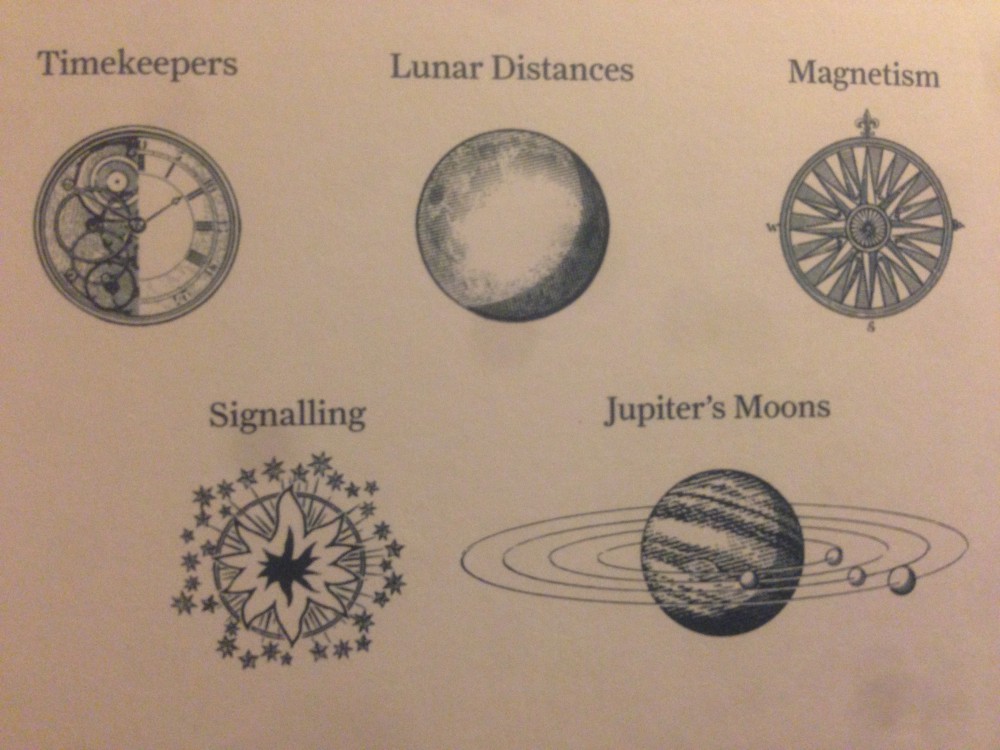 One of the main contenders was an estate worker from Lincolnshire called John Harrison, who had little formal education but was remarkably handy with clocks and machinery. His first submission to the competition was a chronometer, which he entered in 1735. By 1759 he had refined his machine down to the form of a pocket watch, which was tested on the HMS Deptford’s voyage from Portsmouth to Jamaica. Harrison’s son William carried it – in his pocket presumably, so no pressure on that trip, Will! – and on arrival it was found to be less than two minutes, or 18 miles, out. Success! Everything looked rosy until those in charge decided that he wasn’t quite the sort of chap they wanted to award the prize to. Harrison fought his corner for years. William was dispatched to Barbados on another trial in 1764 and this time the chronometer was accurate to within ten miles. Reluctantly, the competition panel agreed to give him some of the money on the condition he spilled the beans about how his invention worked. A copy known as ‘H4’ was made and taken on a jaunt by Captain Cook. He returned triumphant, clutching it in one hand and the first accurate charts of the South Sea Islands in the other. Despite this additional success for Harrison, it took a direct appeal to King George III before the committee would award him what he was owed. Yet even then, it wasn’t the full amount, and was handed over with ill-grace. During the decades the quest rumbled on, Harrison saw some serious competition from a curate and astronomer called Nevil Maskelyne, who came up with the Lunar Distance Method, which is all about measuring the distance between the moon and another body. Everyone go
 t that? Good, because I’m already astronomically out of my depth. Maskelyne too was sent to Barbados (I picture him and William sweating in their powdered wigs, glowering at each other from the shade of opposing palm trees.) Harrison’s machine was more accurate, but Maskelyne’s system was cheaper. Maskelyne was appointed the Astronomer Royal in 1765, which meant he was one of the assessors of the prize as well as an entrant. Hmmm. One of his main jobs at the Royal Observatory (also in Greenwich) was making observations at night, and to ward off the cold he designed an ‘observing suit’, complete with padded feet like a baby’s sleep suit, to wear under his overcoat (that’s the top half of it in the photo). It’s on display in the National Maritime Museum and, as the information panel so delicately phrases it, ‘seems to have been well used.’ Pretty exciting thought isn’t it: this garment may be first known appearance of the Onesie.
 Three hundred years ago, the problem of longitude was the greatest scientific puzzle in the world. It wasn’t just the British government who were trying to solve it either: at around the same time, competitions ran in Spain (our old mucker Philip II), France and the Netherlands. How to solve an equivalent problem in 2014 is the question posed by the Longitude Prize, which opens for submissions today. In an earlier part of the competition, a public vote decided that the rise in our communal resistance to antibiotics was the most important problem. Other contenders for this ‘best problem’ title were: paralysis, dementia, food, water and flight (the latter isn’t ‘why we can’t grow wings ourselves?’ you understand, but rather,’ how can we continue to trundle around the globe on planes without further harming the environment?’). The World Health Organisation estimates that on average antibiotics add 20 years to our lives, yet the rise of antimicrobial resistance is threatening to make them useless. The challenge of the Longitude Prize is to create a cheap, accurate, rapid and easy-to-use test kit for bacterial infections. It has a £10 million prize fund and it’s open to everyone, so if you’ve got a suggestion, drop them a line. I wonder what Alan Sugar’s current crop of apprentices would make of such a challenge? On the episode broadcast on BBC1 on Wednesday November 12th, the charming half-Irish project manager Pamela Uddin ended up in the firing line when her team’s ‘Relationship Guru’ boardgame failed to pass muster. Earlier in the process she described her commitment to the towering pile of dung her team were (inevitably, to my mind) bound to produce as, ‘I’m really passionate about whatever we come up with.’ John Harrison was a genius who spent four decades perfecting his chronometer.
 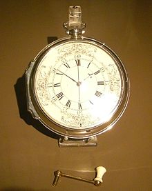 And yet, to paraphrase the voiceover at the end of every episode of The Apprentice, as of today, November 18th 2014, ‘the quest for longitude continues.’
—-
The General Synopsis At Midnight is my exploration of the sea areas of the BBC R4 Shipping Forecast, thanks to the Maeve Binchy Travel Award. The earlier post ‘Counting Down To Midnight’ explains the project. A piece based on the project called ‘The Shipping Forecast’ was broadcast on Sunday Miscellany, RTE Radio 1, November 2nd.
Want to sea more?
Longitude: The True Story of a Lone Genius Who Solved the Greatest Scientific Problem of His Time by Dava Sobel, published by Harper. 
Finding Longitude: How Ships, Clocks and Stars helped solve the Longitude Problem by the National Maritime Museum and Richard Dunn, published by Collins. ‘The Quest for Longitude’ exhibition runs to January 4th 2015.
